Bemaraha National Park is located in the western part of Madagascar, next to the small town of Bekopaka. This park covers an area of more than 157,710 hectares and can only be visited on foot.
The park was initially an Integral Natural Reserve created in 1927 until 1990 when it was declared a UNESCO World Heritage Site and was classified as Bemaraha National Park. It was the third major national park on the island, after Ambre Mountain and Isalo.
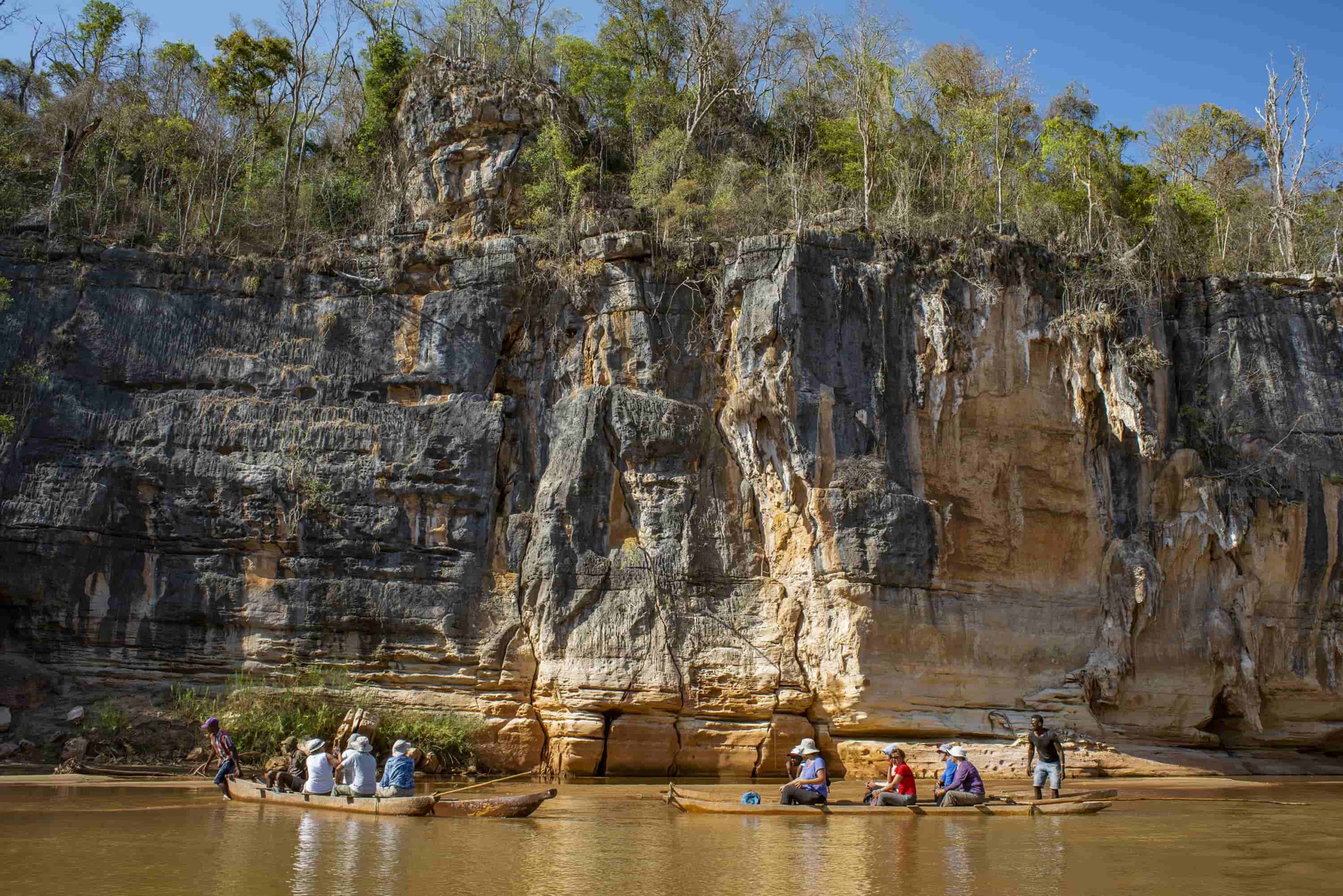
Bemaraha is located in the region of the Sakalava ethnic group, one of the most numerous and interesting of the island and offers a landscape of canyons, gorges, caves, peaks of stoneware of various colors ranging from red to pink, passing through ocher, limestone massifs and granites sculpted through history by water and winds.
All its extension can be considered a true sanctuary for the endemic species of fauna and flora of the island among which stand out some species of lemurs such as Propithecus Deckenii as well as nocturnal lemurs such as the Avahi or Microcebus occidentalis, visible in the forests that give access to the andamozavaky areas, as well as in Ranotsara.
More than 87 species of reptiles and 34 species of amphibians, as well as 103 species of birds, 15 of which are migratory along the banks of the Manambolo River
Its flora is varied and within the park there are more than 800different plant species, especially those of the Angiospermes Dicotyledones group.
The biological diversity of the park, coupled with its spectacular scenery, make it a must-see for all travelers visiting Madagascar.
These are pre-Jurassic plateaus, also colloquially called limestones (ancient seabeds), actually karstic formations (called paleokars) dating back more than 20 million years, when the island was submerged in its northwestern part.
Geographically, we could divide the Bemaraha National Park into three zones:
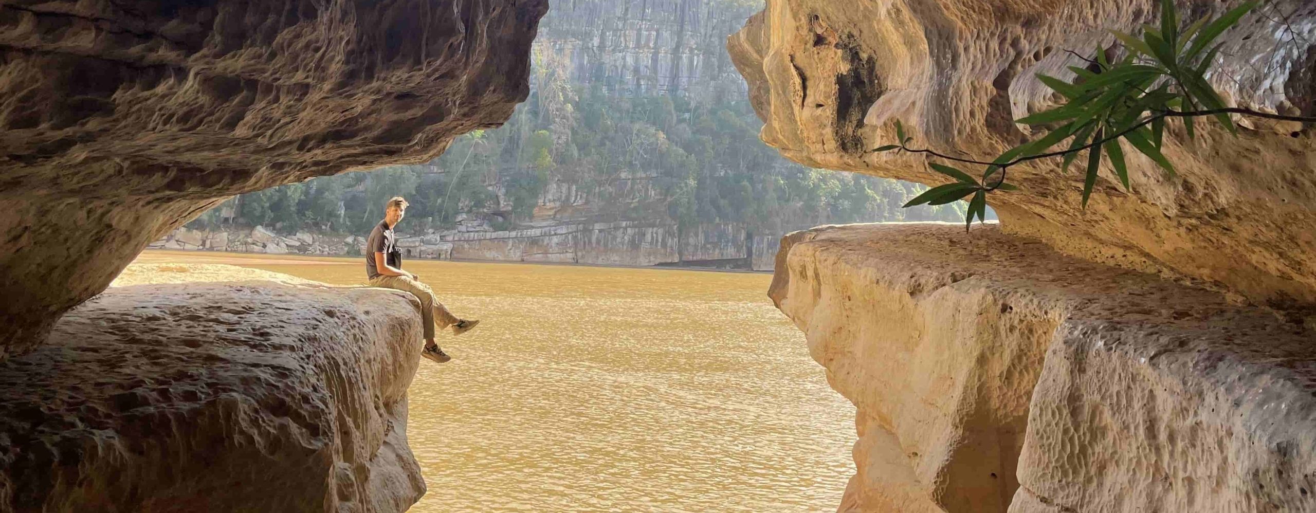
1 – The Manambolo or Manambolobe river banks, where we find the gorges of this river, as well as caves, viewpoints, wooded areas, “vazimba” tombs and the so-called “Little Tsingy”.
2 – Great Tsingy, divided into several groupings of these karst formations in which the areas of Ranotsara and Andamozavaky stand out, as well as a series of subway galleries and caves that allow us to unite both areas of the park in the subsoil. The Great Tsingys are surrounded by wooded areas inhabited by various species of lemurs and savannah.
3 – The Antsavola area, where the caving circuits stand out.
In short, the Tsingy are one of the wonders of Madagascar and it is an unrepeatable pleasure to admire these ancient geological formations surrounded by mystery, in the midst of a spectacular landscape that thrills at certain times of the day, especially with the magnificent sunset.
Sliding through its rocky galleries and crossing its endless natural labyrinths, will become an unforgettable experience for all travelers.
We consider this national park the main one between the months of June and October, for all those circuits that visit the region of Morondava.
Source © IndigoBe Magazine